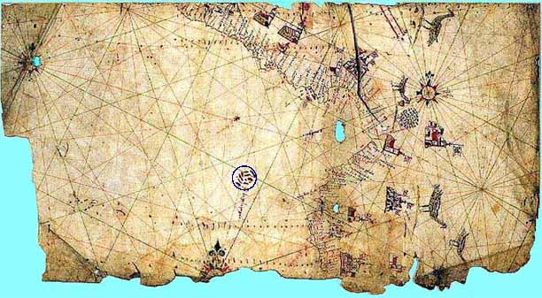
This ancient chart (unknown cartographer) is drawn on vellum which is fine parchment prepared from the skin of lamb or calf. The map depicts the coastline of western Central America and northern South America and clearly shows the Galapagos archipelago (blue circle see detail below), correctly located, off the coast of South America. Said to date from 1530, this may be the oldest known map depicting the islands. However, since the islands were not officially discovered until 1535, the map may be from a later date. Alternatively, the Galapagos may have been added after their existence was reported.
(With permission from J. Woram photo of Library of Congress property)

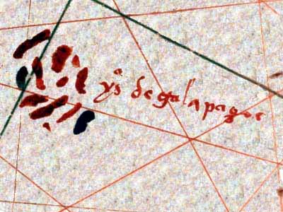
A close look of the 1530 vellum map shows the Galapagos Islands clearly labelled. Although they are inaccurately drawn, they are in the correct location and the spelling of the name ("galapagos") is the same as we use today, even though later maps show some variation on the spelling. For example, Ortelius uses "galepegos" and "galopegos". (see Ortelius 1574 map)
(With permission from J. Woram photo of Library of Congress property)
