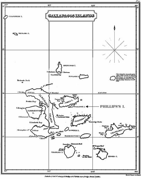
This chart from 1823 was made by English engraver Samuel John Neele (1758-1824). The map shows how cartography was developing from an art into a science (compare this with the 18th century maps). Relative positions of the islands and distances between them are fairly accurate. Shapes of the islands, likewise are mostly correct. Only Albemarle (Isabela) is significantly misproportioned, with the southern part of the island shown much smaller than in reality. In this map, the islands retain their English names, although what was King Charles' Island is renamed Chatham, and what was Crossman's Island is now Charles Island. The map was originally published in A Voyage in the South Seas (published in London by Phillips and Co., earlier editions published 1815 in Philadelphia: Bradford and Inskeep, which lacks the map, and 1822 in New York: Wiley & Halstead). This book was from an account by American David Porter who commanded the frigate Essex on a three year voyage around the Pacific.
(with permission from John Woram's collection)